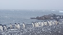
Joinville Island
The island is completely ice-capped, the summit of which is Mount Percy, about 2,510 feet high, a flat cupola with twin-peaked feature.The north coast is marked by two rugged headland promontories, Capes King and FitzRoy, between which are two bays ...[3] Joinville Island was discovered and charted roughly during 1838 by a French expedition commanded by Captain Jules Dumont d'Urville, who named it for François d'Orléans, Prince of Joinville (1818–1900), the third son of Louis-Philippe, Duke of Orléans.Reddish rock cliffs rising steeply from the sea to about 305 metres (1,001 ft) high and forming the north side of the entrance to Suspires Bay, at the west end of Joinville Island.A gently sloping valley, filled with ice, lying east of Suspires Bay in the west part of Joinville Island.A bay 3.5 nautical miles (6.5 km; 4.0 mi) wide at its entrance, lying east of Boreal Point along the north coast of Joinville Island.A point marking the west side of the entrance to Ambush Bay on the north coast of Joinville Island.A bay 3.5 nautical miles (6.5 km; 4.0 mi) wide indenting the north coast of Joinville Island immediately east of King Point.A low point at the east side of Fliess Bay forming the northeast extremity of Joinville Island.Discovered by a British expedition, 1839-43, under James Clark Ross, and named by him for Captain Jules Dumont d'Urville.An isolated reef lying 3 nautical miles (5.6 km; 3.5 mi) east of D'Urville Monument, Joinville Island, in Active Sound.Named in 1956 by UK-APC after Diana (Robert Davidson, master), one of the ships of the Dundee whaling expedition which visited the Joinville Island area in 1892-93.A small but prominent isolated nunatak, 440 metres (1,440 ft) high, standing 3 nautical miles (5.6 km; 3.5 mi) south of Mount Tholus in the southern part of Joinville Island.The highest mountain, 825 metres (2,707 ft) high, in the ridge extending southwest from Postern Gap in the central part of Joinville Island.A small bay on the south side of Joinville Island, lying just west of Mount Alexander at the junction of Active Sound and the Firth of Tay.Discovered by a British expedition under Ross on December 30, 1842, and named for Rear Admiral the Honorable Josceline Percy, RN, 1784-1856.The cliff marking the extremity of the peninsula was discovered and named Cape Alexander on January 8, 1893 by Thomas Robertson, master of the ship Active, one of the Dundee whalers.A rocky headland 6 nautical miles (11 km; 6.9 mi) east of Mount Alexander, extending into the Firth of Tay on the south coast of Joinville Island.

AntarcticaJoinville Island groupAntarctic PeninsulaAntarctic SoundGraham LandTrinity PeninsulaD'Urville IslandDanger IslandsDundee IslandJules Dumont d'UrvilleFrançois d'Orléans, Prince of JoinvilleLouis-Philippe, Duke of OrléansMadder CliffsFalkland Islands Dependencies SurveyUK Antarctic Place-Names CommitteeDundeePhillip Parker KingAmbush Bay (Antarctica)James Clark RossRobert FitzroyD'Urville MonumentActive SoundFirth of TayArgentine Antarctic ExpeditionGuillermo Brownwilliwawspublic domain materialUnited States Board on Geographic NamesDefense Mapping AgencyNational Geospatial-Intelligence AgencyWest AntarcticaPalmer LandEllsworth LandEnglish CoastBryan CoastEights CoastKing Edward VII LandShirase CoastMarie Byrd LandWalgreen CoastBakutis CoastHobbs CoastRuppert CoastSaunders CoastQueen Elizabeth LandAbbot Ice ShelfFilchner–Ronne Ice ShelfGetz Ice ShelfLarsen Ice ShelfRoss Ice ShelfSulzberger Ice ShelfAmundsen SeaDean IslandGrant IslandSiple IslandBellingshausen SeaAdelaide IslandAlexander IslandLatady IslandRothschild IslandSherman IslandSmyley IslandSpaatz IslandThurston IslandRoss SeaRoss IslandScotia SeaSouthern OceanAnvers IslandBrabant IslandCharcot IslandCoronation IslandElephant IslandKing George IslandLivingston IslandRenaud IslandWeddell SeaJames Ross IslandHearst Island