Walgreen Coast
It was discovered by Richard E. Byrd and members of the US Antarctic Service (USAS) by flights from the USS Bear during February 1940.This coast was mapped in detail by the United States Geological Survey from ground surveys and U.S. Navy air photographs, 1959–66.It contains Thwaites Glacier, also known as the "Doomsday Glacier", for its major contributions to sea level rise as a result of climate change.This article incorporates public domain material from "Walgreen Coast".This Marie Byrd Land location article is a stub.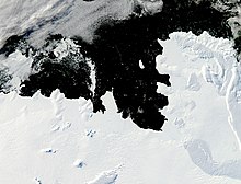
SatelliteAntarcticaCape HerlacherCape WaiteEights CoastBakutis CoastMarie Byrd LandRichard E. ByrdUS Antarctic ServiceUSS BearCharles R. WalgreenWalgreensByrd Antarctic ExpeditionUnited States Geological SurveyU.S. NavyThwaites Glaciersea level riseclimate changeWright PassGeographic Names Information SystemWest AntarcticaAntarctic PeninsulaGraham LandPalmer LandEllsworth LandEnglish CoastBryan CoastKing Edward VII LandShirase CoastHobbs CoastRuppert CoastSaunders CoastQueen Elizabeth LandAbbot Ice ShelfFilchner–Ronne Ice ShelfGetz Ice ShelfLarsen Ice ShelfRoss Ice ShelfSulzberger Ice ShelfAmundsen SeaDean IslandGrant IslandSiple IslandBellingshausen SeaAdelaide IslandAlexander IslandLatady IslandRothschild IslandSherman IslandSmyley IslandSpaatz IslandThurston IslandRoss SeaRoss IslandScotia SeaSouthern OceanAnvers IslandBrabant IslandCharcot IslandCoronation IslandD'Urville IslandElephant IslandJoinville IslandKing George IslandLivingston IslandRenaud IslandWeddell SeaJames Ross IslandHearst Island