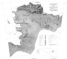
Abbot Ice Shelf
The full extent was mapped by the United States Geological Survey (USGS) from USN air photos of 1966.The feature was discovered by members of the USAS in flights from the ship Bear in February 1940, and was further delineated from air photos taken by United States Navy Operation Highjump in December 1946.The sound was first noted to parallel the entire south coast of Thurston Island, thereby establishing insularity, by the United States Navy Bellingshausen Sea Expedition in February 1960.The feature was positioned by parties from the USS Glacier and Stolen Island in February 1961, and was mapped by USGS from United States Navy air photos of 1966.Farwell, Chief of Staff to the Commander, United States Naval Support Force, Antarctica, during Deep Freeze 1968 and 1969.An oval-shaped island, 7 nautical miles (13 km; 8.1 mi) long, within the Abbot Ice Shelf of Peacock Sound.A small conspicuous rocky nunatak 2 nautical miles (3.7 km; 2.3 mi) southwest of Dentler Island, lying near the inner part and east end of Abbot Ice Shelf.Named by US-ACAN for Larry K. Lepley, oceanographer of the United States Navy Hydrographic Office, who with three others was marooned at this nunatak, February 12-15, 1961, by a severe wind and snowstorm.
Coordinatesice shelfEights CoastCape WaitePfrogner PointThurston IslandDustin IslandMcNamara IslandBellingshausen SeaAmundsen SeaKing PeninsulaJones MountainsFletcher PeninsulaVenable Ice ShelfUnited States Antarctic ServiceUnited States NavyOperation HighjumpUnited States Geological SurveyAdvisory Committee on Antarctic NamesJames Lloyd Abbot Jr.public domain materialUnited States Board on Geographic Names