Filchner–Ronne Ice Shelf
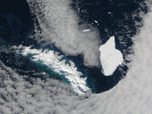
The seaward side of the Filchner–Ronne ice shelf is divided into Eastern (Filchner) 79°00′S 40°00′W / 79.000°S 40.000°W / -79.000; -40.000 and the larger Western (Ronne) 78°30′S 61°00′W / 78.500°S 61.000°W / -78.500; -61.000 sections by Berkner Island.Commander Finn Ronne, USNR, leader of the Ronne Antarctic Research Expedition (RARE) in 1947–48, discovered and photographed a strip along the entire northern portion of this ice shelf in two aircraft flights in November and December 1947.The east part of this shelf was discovered in January–February 1912 by the German Antarctic Expedition under Wilhelm Filchner.A large group of small icebergs (the largest some 1000 metres in length), were seen off the south-east coast of the island, with one of them drifting close enough to shore to be visible from the hills above the city of Dunedin.[5] A study published in Nature in 2012 by scientists from the Alfred Wegener Institute for Polar and Marine Research in Germany, and funded by the Ice2Sea initiative, predicts the disappearance of the 450,000 km2 (170,000 sq mi) vast ice shelf in Antarctica by the end of the century which could – indirectly – add up to 4.4 mm (0.17 in) of rise of sea level each year.
Filchner-Ronne ice shelf in blue with other ice shelves


calvingAntarctic ice shelfWeddell Seaice shelfBerkner IslandRoss Ice ShelficebergsAntarctic PeninsulaGraham LandZumberge CoastOrville CoastEllsworth LandFinn RonneRonne Antarctic Research ExpeditionEllsworth StationEdith Ronne LandPalmer LandAdvisory Committee on Antarctic NamesEdith RonneCoats LandGerman Antarctic ExpeditionWilhelm FilchnerKaiser WilhelmSlessor GlacierRecovery GlacierSupport Force Glacierspongesiceberg A-38DelawareSouth IslandNew ZealandDunedinRhode IslandModerate-Resolution Imaging SpectroradiometerIceberg A-76MajorcaIceberg A-74BelgiumNatureAlfred Wegener Institute for Polar and Marine ResearchIce2SeaBelgrano I BaseFilchner TroughGrand ChasmsWeddell GyreNational Institute of Water and Atmospheric ResearchWayback MachineWest Antarctic Ice SheetScientific AmericanNational Snow and Ice Data CenterScience NewsGeographic Names Information SystemUnited States Geological Survey