British Columbia Highway 15
[6][citation needed] Border crossing times can become significantly delayed such as in the event of certain Seattle Mariners baseball games and summer holiday travel.Highway 15 travels around a commercial district and returns east to its original alignment on 176th Street as it passes Cloverdale's casino and fairgrounds.[19] On December 21, 2013, the C$1 billion South Fraser Perimeter Road opened as part of Highway 17, linking the northern terminus of BC 15 to Delta in the west.[22] A 1.3-mile (2.1 km) expressway to serve the border crossing and connect it with I-5 was planned in the late 1960s to relocate truck traffic from city streets.[29] The Washington State Department of Transportation began reconstruction of SR 543 in May 2006 to expand the highway to five lanes between H Street and the border crossing.The existing truck lane was closed in October 2006 and was rebuilt to separate freight traffic from other vehicles accessing the border crossing and adjacent duty free store.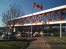
B.C. MoTBlaine, WashingtonCanada–US borderHighway 10SurreyGolden Ears WayHighway 1 (TCH)Highway 17CanadaBritish Columbia provincial highwaysState highways in WashingtonInterstateScenicPre-19641964 renumberingFormerHighway 14Highway 16SR 542SR 544Interstate 5Peace ArchPacific Highway Border CrossingCanada–United States borderBlaine High Schoolmunicipal airportduty free storesFree and Secure TradeSeattle Marinersattacks of September 11Surrey, British ColumbiaHighway 99divided highwayNicomekl RiverCloverdaleSouthern Railway of British ColumbiaHighway 10NewtonLangleycasinoFraser HighwaySerpentine RiverFraser RiverPitt MeadowsHighway 1Trans-Canada HighwayHighway 17Metro VancouverSouth Fraser Perimeter RoadGreat Northern RailwayWashington State Department of Transportationtruck laneduty free storeWashingtonWhatcomBlaineBellinghamSeattleBritish ColumbiaHighway 99White RockVancouverPeace Arch Border CrossingHighway 1ANew WestminsterMaple RidgeRick LarsenGoogle MapsCanada Border Services AgencyCKWX-AMSeattle Post-IntelligencerCity of SurreyProQuestNewspapers.comThe Seattle TimesProvincial highwaysAtlin RoadColumbia Valley HighwayAlaska HighwayBanff–Windermere HighwayCaribou HighwayCoquihalla HighwayCrowsnest HighwayDon Phillips WayHeritage HighwayInland Island HighwayInternational Selkirk LoopJohn Hart HighwayLiard HighwayLougheed HighwayMary Hill BypassNisga'a HighwayNorthern Woods and Water RouteOkanagan ConnectorOkanagan HighwayPatricia Bay HighwaySea to Sky HighwaySouthern Yellowhead HighwayStewart–Cassiar HighwaySunshine Coast HighwayYellowhead HighwayBig Bend HighwayCariboo RoadChilkoot TrailDewdney TrailDewdney Trunk RoadDouglas RoadHudson's Bay Brigade TrailLillooet Cattle TrailOkanagan TrailOld Cariboo RoadOld Yale RoadPacific HighwayRiver TrailWhatcom TrailexpresswayfreewayGreater VancouverDunbar StreetBurrard StreetGranville StreetGranville MallOak StreetCambie StreetMain StreetFraser Street