Bean Station, Tennessee
During the 18th and 19th centuries, due to its strategic location at the crossroads of Daniel Boone's Wilderness Road and the Great Indian Warpath, the town grew to become an important stopover for early pioneers and settlers in the Appalachia region.During the American Civil War, the town was the site of the final battle of the Knoxville campaign before Confederate forces surrendered to a Union blockade in nearby Blaine.[3] During the American Revolutionary War, Bean served as a captain for the Virginia militia; in 1776, he was awarded over 3,000 acres (4.7 sq mi; 1,200 ha) in the German Creek valley, where he had earlier surveyed and camped with Boone.[3] At this site, Bean later constructed a four-room cabin, which he used as both his family home and as an inn for prospective settlers, fur traders, and longhunters.Confederate Army General James Longstreet attempted to capture Bean Station en route to Rogersville after failing to drive Union forces out of Knoxville.A fire destroyed the main hotel structure in 1963, and the only remnants of the complex were cabins, the pool bathhouse, and Tate Springs Springhouse, the last of which was listed on the National Register of Historic Places in 1973.The company helped fund and propose plans to develop the town as an important multimodal distribution rail-and-road center, such as an extension of the Peavine Railroad across Clinch Mountain to Cumberland Gap, and northeast to Bristol.[24] The popularity of Tate Springs resort located in eastern Bean Station peaked between the 1890s and 1920s when the railroad provided passenger rail connections to the site.[24] Initial plans for the construction of Cherokee Dam by the Tennessee Valley Authority (TVA) several miles downstream along the Holston River included the impounding of the site of Bean Station.[34][35] Farmers in the town and surrounding area opposed the route through Bean Station, and roadway planners and engineers were also reportedly swooned[clarification needed] by officials in Greene and Hamblen counties.[1] In 1977, residents of Bean Station again petitioned to incorporate into a city, whose new boundaries would include portions of the neighboring community Mooresburg across the Hawkins County line.[41] In the mid-1990s, rumors portions of southern Bean Station may be annexed into Morristown spread throughout the community, leading residents to petition a third incorporation election in 1994.[44][45] The collision led to protests and calls for traffic safety and infrastructure improvements, including the widening of 11W and other state highways, and the completion of I-81 in Tennessee to alleviate congestion on 11W.[62] Following the opening of the last section of I-81 in Tennessee in December 1974, Bean Station experienced a 60% decline in business as a result of decreased traffic on US 11W.[37] Increased, sprawling residential development in Bean Station and residents commuting to neighboring Morristown led to overcapacity on two-lane 25E.[37] In the 1980s, US-25E was widened to a four-lane limited-access highway from Lakeshore Drive to across Cherokee Lake into Morristown, and from the gap at Clinch Mountain to the base near the westernmost junction of 11W and 25E in Bean Station.[74] Bean Station Elementary School, which is located in the westernmost part of the town, is operated by the Grainger County Department of Education.Tennessee State Route 375 (SR 75, Lakeshore Drive) also intersects US 25E south of the CBD and traverses several of Bean Station's affluent outskirt lakefront neighborhoods and subdivisions.Bean Station was referenced on the NBC police procedural comedy series Brooklyn Nine-Nine; one of the show's secondary characters Bill Hummertrout cites it as his hometown.


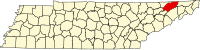
US 11WCountryTennesseeCountiesGraingerHawkinsIncorporatedWilliam BeanNamed forMayor-councilVice MayorTown CouncilTime zoneEastern (EST)ZIP codeArea codesFIPS code2020 censusKingsportKnoxvilleDaniel BooneWilderness RoadGreat Indian WarpathAppalachiaAmerican Civil WarKnoxville campaignConfederateBlaineTate SpringsJohn K. ShieldsTennessee Valley AuthorityCherokee Damremovedeminent domainU.S. Route 11WU.S. Route 25EMorristownHamblen CountyClinch MountainAmerican Revolutionary WarVirginia militiafur traderslonghuntersblacksmith's shopCumberland GapNew OrleansWashington, D.C.Andrew JacksonAndrew JohnsonJames K. PolkBattle of Bean's StationConfederate ArmyJames LongstreetRogersvillefailing to drive Union forces out of KnoxvilleUnion ArmyJames M. ShackelfordVictorian-stylemineral springGreat DepressionNational Register of Historic PlacesHolston RiverSouthern RailwayCorrytonbedroom communitystreet gridmultimodal distributionBristolGovernment of Tennesseeplanned villageNorrisNorris Project1972 Bean Station bus-truck collisiontrucking industrytruck stopsInterstate Highway SystemInterstate 81incorporateMooresburghead-on collisionGreyhoundopioidsCity limitsCherokee LakeU.S. Census BureauunincorporatedannexedBlack or African AmericanNative AmericanOther/MixedHispanicLatino2020 United States census2010 United States Censusof two or more racesHispanic or LatinoIGA MarketClayton Homeslimited-access highwaycentral business districtGuinness World Recordmayor-aldermenTennessee House of RepresentativesRick EldridgeRepublican8th districtTennessee SenateFrank Niceley2nd congressional districtUnited States House of RepresentativesTim BurchettGrainger High SchoolRutledgebroadband internetTennessee Department of TransportationEast TennesseeTazewellClaiborne CountyTennessee State Route 375US 11WLee HighwayUS 25ESR 32East Tennessee Crossing BywaySR 375Peter Ellis Bean