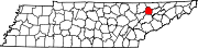
Union County, Tennessee
The county seat was originally named "Liberty", but renamed "Maynardville" in honor of attorney and congressman Horace Maynard, who had defended the county in a court case that sought to block its formation.[1] In the 1930s, the damming of the Clinch River by the construction of Norris Dam by the Tennessee Valley Authority (TVA) to form Norris Lake inundated a large part of the county,[5] including the community of Loyston, and displaced many residents."The Move," what many displaced families called the forced relocation by TVA, would encounter criticism, as the promise of electrification of Union County would not come after the completion of Norris Dam, but two decades later in the mid-1950s.[8] The county is situated in the Ridge-and-Valley Appalachians, a range characterized by long, narrow ridges alternating with similarly shaped valleys.The "Loyston Sea", one of the widest sections of Norris Lake, is located in Union County just north of the state park.[9] As of the 2020 United States census, there were 19,802 people, 7,405 households, and 5,471 families residing in the county.


CountyMaynardvilleTennesseeNamed forTime zoneUTC−5EasternUTC−4ZIP CodesArea codeU.S. state2020 censuscounty seatKnoxvillemetropolitan statistical areaGraingerClaiborneCampbellAndersonEast TennesseeCivil WarHorace MaynardClinch RiverNorris DamTennessee Valley AuthorityLoystonNational Park ServiceCivilian Conservation CorpsBig Ridge State ParkU.S. Census BureauRidge-and-Valley AppalachiansClinch MountainClaiborne CountyGrainger CountyKnox CountyAnderson CountyCampbell CountyBlack or African AmericanNative AmericanPacific IslanderOther/MixedHispanicLatino2020 United States censuscensuspopulation densityracial makeupmedian household incomeper capita incomepoverty lineClayton HomesFood CityTennessee Virtual AcademyLuttrellPlainviewAlder SpringsBradenSharps ChapelRoy AcuffChet AtkinsJake ButcherKenny ChesneyJohn Rice IrwinMuseum of AppalachiaFlorence ReeceWhich Side Are You On?Carl SmithRepublicanDemocraticThird party(ies)United States Census BureauTennessee Blue BookState of TennesseeCitiesUnincorporatedcommunitiesGhost townKnoxville metropolitan areaBean StationBlaineClintonFarragutJefferson CityLaFolletteLenoir CityMaryvilleMorristownOak RidgeNewportRutledgeSeviervilleBlount CountyCocke CountyHamblen CountyJefferson CountyLoudon CountyMorgan CountyRoane CountySevier CountyNashvilleAbortionCannabisClimate changeHistoryOutlineGeographyGun lawsHomelessnessTennesseansAfrican AmericansLGBT rightsnewspapersConstitutionElectionsGovernorLieutenant GovernorGeneral AssemblySupreme CourtTennessee National GuardLaw enforcementSymbolsColleges and universitiesDemographicsEconomyEducationLiteratureGrand Divisions