Steinwald
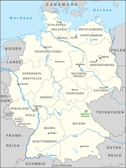
The Steinwald lies south of the Upper Franconian county town of Marktredwitz and north of Erbendorf in the district of Tirschenreuth.On the other hand, the heavily thinned areas of forest result in a rapid transformation that helps to prevent attack by bark beetle.This is due to the high levels of sulphur dioxide emission from the burning of brown coal in the nearby Eger Basin, to acid rain and to the many days of mist and fog.Research to date has shown that its causes are complex and involve biotic and abiotic factors, however environmental pollution plays a significant role.Forestry management measures include fertilising in order to counteract the lack of magnesium which causing a yellowing of the pine needles.The High Steinwald may be reached on trails running from Neusorg, Waldershof, Marktredwitz, Poppenreuth, Fuchsmühl, Friedenfels and Erbendorf.


Kösseinemountain rangesea level (NN)Germanynature parkUpper PalatinateBavariaUpper FranconianMarktredwitzErbendorfTirschenreuthFichtel MountainsWaldnaabsea levelPlatteUpper Palatinate TowerArmesbergGroßer TeichelberggranitebasaltParksteinWeidenRauhe KulmKemnathprecious stonesjaspersideritelimonitehaematiteMiddle AgeslithiumspringsEuropeWiesauPrince Regent Luitpold of BavariaOtto I of Greecesoil qualityphyllitequartzitekaolinAlpineconifersspruceblueberriescranberriescryptogamsArctic starflowerFichtelgebirge Clubred deerwild boarred foxweaselpolecatWoodpeckersgoshawkseagle-owlstawny owlspygmy owlsTengmalm's owlblack storkscapercailliebark beetleWaldsterbensulphur dioxidebrown coalacid rainOre MountainsUpper Palatine ForestBavarian ForestWaldsassenNeuenmarkteducational trailFriedenfelsNeusorgWaldershofFuchsmühlList of nature parks in GermanyCentral UplandsAnterior Bavarian ForestEinödriegelBlack ForestFeldbergBohemian ForestGroßer ArberDeisterBröhnEbbe MountainsNordhelleEgge Mountains(Prussian) VelmerstotHohe AchtVolcanic EifelErnstbergElbe Sandstone MountainsGroßer ZschirnsteinEilumer HornElster MountainsKapellenbergSchneebergFranconian ForestDöbrabergFranconian JuraDürrenbergGladenbach UplandsAngelburgGoshawk ForestHohes GrasBrocken (Blocksberg)Hildesheim ForestGriesbergBloße ZelleHoher MeißnerKasseler KuppeHunsrückErbeskopfSoonwaldEllerspringKaiserstuhlTotenkopfKaufungen ForestHirschbergKellerwaldWüstegartenKnüllEisenbergKyffhäuser