Hualapai
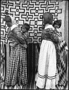
The Hualapai (pron [walapaɪ], wah-lah-py, Walapai: Hwalbáy[1]) are a federally recognized Native American tribe in Arizona with about 2300 enrolled citizens.Their traditional territory is a 108-mile (174 km) stretch along the pine-clad southern side of the Grand Canyon and the Colorado River with the tribal capital at Peach Springs.The Peach Springs School District runs a successful bilingual program for all local students, both Hualapai and non-Hualapai, in addition to immersion camps.The Hualapai Reservation (35°54′25″N 113°07′58″W / 35.90694°N 113.13278°W / 35.90694; -113.13278), covering 1,142 square miles (2,960 km2), was created by the Presidential Executive order of Chester A. Arthur on January 4, 1883.,[3] it is located in Coconino and Mohave counties.The war broke out in May 1865, when the Hualapai leader Anasa was killed by a man named Hundertinark in the area of Camp Willow Grove and in March 1866.In response, a man named Clower was killed by the Hualapai, who also closed the route from Prescott, Arizona, to the Colorado River ports due to the conflict.However, the agreement lasted only nine months when it was broken with the murder of Chief Wauba Yuba near present-day Kingman during a dispute with the Walker Party over the treaty.


Hualapai (disambiguation)WalapaiEdward CurtisUnited StatesArizonaHualapaiChristianityMohaveYavapaiHavasupaiCoconinoponderosa pineGrand CanyonColorado RiverPeach SpringsValentineGrand Canyon WestHualapai languageYuman–Cochimí languagesYavapai peopleExecutive orderChester A. ArthurWikiupHualapai WarEuropean AmericansPrescott, ArizonaWalker PartyFort MojaveMohave peoplewhooping coughdysenteryDobynsQuartermaster CanyonDiamond Creek Canyon (Gwada)Hualapai ValleyPeacock MountainsGrand Wash CliffsHackberry [Springs]Crozier [Spring]Colorado PlateauPeach Springs (Hàkđugwi:v)Havasu CreekCataract Canyon (Havasu Canyon)KingmanCerbatBlack MountainsDetritalSacramento ValleysLake MeadCerbat Mountains (Ha'emede:)Beale's SpringsHoover DamTemple BarDolan SpringsHualapai MountainsWalnut CreekBig Sandy RiverWikieupSignalUpper Burro Creek WildernessChemehueviPeach Springs Unified School DistrictHackberry School DistrictValentine Elementary School DistrictMusic Mountain Junior/Senior High SchoolKingman Unified School DistrictSeligman Unified School DistrictBat Cave mineGrand Canyon SkywalkKiowa GordonWatahomigie, LucilleAmerican Indian QuarterlyWayback MachineSheridan, Thomas E.University of Arizona PressU.S. Census BureauParadise Valley Unified School DistrictIndigenous peoplesChiricahuaCocopahHalchidhomaMaricopaNavajoSouthern PaiuteQuechanHopi-TewaOʼodhamTohono OʼodhamAkimel O'odhamTonto ApacheSouthern UteWestern ApacheAncestral PueblodwellingsBasketmakerCohoninaHohokamMogollonPatayanSaladoSinaguaList of Indian reservations in ArizonaBlack Suspension BridgeBridge Canyon DamGrand Canyon EscaladeGrand Canyon National ParkGrand Canyon Village, ArizonaKolb StudioMarble Canyon DamMaswik LodgePhantom RanchGeologyAgave phillipsianaApollo TempleCardenas BasaltDox FormationEricameria arizonicaEsplanade SandstoneGrand Canyon CavernsGrand Canyon Forest ReserveGrand Canyon–Parashant National MonumentGrand Canyon SupergroupChuar GroupNankoweap FormationSixtymile FormationUnkar Group