Grand Coteau, Louisiana
The first known land grant by the colonial Louisiana government was in 1776 in the area referred to as Buzzard Prairie.The thriving community had two bakeries, a cobbler, a millinery, a blacksmith shop, a post office, six bars, and nine brothels.[6] Although thousands of Union troops were encamped in the fields surrounding the Academy during the Civil War, the school was not touched.[3] In the 19th century the population of Grand Coteau grew with African-Americans, free people of color, Acadians, Creoles, French, Irish, and German immigrants.[8] According to the United States Census Bureau, the town has a total area of 2.4 square miles (6.2 km2), all land.The climate in this area is characterized by hot, humid summers and generally mild to cool winters.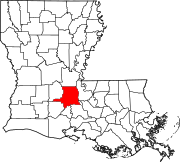
St. LandryTime zoneArea codeFIPS codeSt. Landry ParishLouisiana2010 censusInterstate 49OpelousasEuniceMicropolitan Statistical AreaWashington, LouisianaSt. Martinville, Louisianabakeriescobblermillineryblacksmithpost officeSt. Charles, MissouriReligious of the Sacred HeartconventAcademy of the Sacred HeartSt. Charles CollegeNinety-ninth infantry regiment of IllinoisBattle of Grand CoteauNew OrleansCivil WarAfrican-Americansfree people of colorAcadiansCreolesFrenchGermanVictorian architectureUnited States Census BureauBlack or African AmericanNative AmericanOther/MixedHispanicLatino2020 United States census2010 United States CensuscensusAfrican AmericanPacific Islanderother racesmarried couplesper capita incomepoverty lineKöppen Climate Classificationhumid subtropical climateprecipitationWayback MachineSt. Landry Parish, LouisianaParish seatCitiesArnaudvilleKrotz SpringsLeonvilleMelvillePort BarreSunsetWashingtonVillagesCanktonPalmettoLawtellMorrowOthercommunitiesBristolGrand PrairieLebeauLe MoyenPlaisanceWhiteville