Chalon–Champforgeuil Airfield
Chalon–Champforgeuil Airfield (French: Aéroport de Chalon–Champforgeuil, ICAO: LFLH) is an airfield located at Champforgeuil, 7 kilometres (4.3 mi) north-northwest of Chalon-sur-Saône, both communes of the Saône-et-Loire department in the Burgundy (Bourgogne) region of France.[1] The aerodrome resides at an elevation of 623 feet (190 m) above mean sea level.It has one asphalt paved runways designated 17/35 which measures 1,440 by 30 metres (4,724 ft × 98 ft).It also has a parallel grass runway measuring 850 by 50 metres (2,789 ft × 164 ft).This French airport-related article is a stub.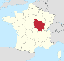
Chalon-sur-SaôneFranceChampforgeuilCoordinatesBurgundyRunwaysFrenchcommunesSaône-et-Loiredepartmentregionelevationmean sea levelasphaltService d'information aéronautiqueAirportsMarseilleParis–Charles de GaulleParis–OrlyToulouseAjaccioBasel Mulhouse FreiburgBastiaBeauvaisBergeracBéziersBiarritzBordeauxCarcassonneChâlons–VatryChambéryClermont-FerrandDeauvilleFigariGrenobleLa RochelleLimogesLourdesMontpellierNantesNîmesPerpignanPoitiersRennesSaint-TropezStrasbourgToulonAurillacCastresLe PuyLorientUshantArutuaBora BoraCayenneDzaoudziFort-de-FranceHuahineMiquelonNouméa–La TontoutaNouméa–MagentaPointe-à-PitrePierrefondsRaiateaRéunion Roland GarrosSaint-PierreSt. BarthélémySt. Martin–Grand CaseTahiti–Fa'a'āAbbevilleAlbert PicardieAlpe d'HuezAngersAngoulêmeAnnecyAubenasAuxerreAvignonBarcelonnetteBourgesCalaisCannesChalon-sur-SaoneChâteaurouxCherbourgColmarCourchevelDinardÉpinalHazebrouckÎle d'YeuLannionLe HavreLe TouquetLyon–BronMegèveMéribelMontluçonMorlaixMoulinsNancy-EsseyOrléansParis–Le BourgetPérigueuxPontoiseQuimperSaint-BrieucSaint-ÉtienneSaint-InglevertSaint-NazaireSaint-YanToussus-le-NobleTroyesValenceVannesVillefrancheStatistics