2018 Washington wildfires
[5] A 20-year Washington Wildland Fire Protection Strategic Plan under development during the first half of the year was to be released by the Department of Natural Resources to the public in July, 2018.[10] Climate scientists said in July that the Palmer Drought Severity Index showed Western Washington to be significantly drier than normal, adding to fire risk there.[11] Download coordinates as: What may have been the first significant fire of the year occurred on April 24, when 20 acres burned at Woodland, Washington in Clark County, extinguished via aerial attack.[14] The Ryegrass Coulee Fire on July 9–10 burned 1,600 acres, closed 20 miles of Interstate 90 in both directions for most of a day, and forced the complete evacuation of Vantage, Washington.It burned 80,000 acres, mostly on the Yakima Training Center, caused level three "leave now" evacuations, and destroyed five buildings while being fought by three fixed-wing aircraft and two helicopters.[30] Smoke from fires in Siberia was visible over southern British Columbia in late July and was assessed to be a possible health impact to Washington residents."[32] On July 30, University of Washington meteorology professor Cliff Mass noted the progressively more smoky situation in Seattle from Siberian wildfires, and said a "smoke front" from California's Carr Fire would arrive before sunset.[45] The Governor's July 31 state of emergency declaration allowed the Washington National Guard to be deployed; two Blackhawk helicopters at Fairchild Air Force Base were quickly allocated to firefighting.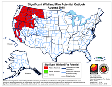


state of emergencyJay InsleeCascade MountainsWestern WashingtonNational Interagency Fire Centersnow packwater yearEl Niño–Southern OscillationEastern WashingtonPalmer Drought Severity IndexWoodland, Washingtonaerial attackcontrolled burnYakima Training CenterSoap Lake FireGrant CountyInterstate 90Vantage, WashingtonFederal Emergency Management AgencyLeavenworth, WashingtonVulcan Mountainfires in SiberiaPuget Sound Clean Air AgencyPuget Sound regionCarr FireGoat Rocks WildernessColumbia GorgeWishram, WashingtonState Route 14smokejumpersMaple FireHamma Hamma Riverinfrared thermographyWashington Air National GuardWashington National GuardFairchild Air Force BaseHilary FranzKIMA-TVNBC 23 NewsWayback MachineThe Wenatchee WorldTwitterThe New York TimesKHQ-TV2018 wildfiresBritish ColumbiaNorth BayParry SoundCaliforniaMontanaNevadaOregonRussiaAttica (Greece)SwedenUnited KingdomAustralia (17-18)◀ 20172019 ▶Washington wildfiresYacolt BurnGreat FireDollar MountainWhite MountainMount LeonaThirtymileSchoolTripod ComplexTatooshCold SpringsCarlton ComplexOkanogan ComplexRange 12Diamond CreekJack Creek FireUno Peak FireSoap Lake243 Command FireLeft Hand FireEvans CanyonLabor DaySchneider Springs FireEagle Bluff FireGray FireOregon FireNewell Road FireSourdough FireTunnel Five FirePioneer FireRetreat FireSwawilla Fire