
Mass shootings in Thailand
2 min
2026 Debsirin Nonthaburi School Shooting
The shooting occurred on August 7, 2026, in Nonthaburi, Thailand.
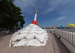
Nonthaburi is a central province (changwat) in Thailand, situated within the Chao Phraya River basin. It is part of the greater Bangkok Metropolitan Region and is characterized by its high level of urbanization, with its administrative boundaries often appearing indistinguishable from the capital, Bangkok.
The area was established as a city in the mid-16th century, originally known as Talat Khwan. During the reign of King Prasat Thong, a canal was excavated to create a shortcut for the Chao Phraya River, which eventually became the main riverbed. In 1665, King Narai commissioned the construction of a fortress to protect the route to the then-capital, Ayutthaya. The town was subsequently relocated near this fortification. In the modern era, Nonthaburi was incorporated into Bangkok from 1943 to 1946 before being re-established as an independent province on May 9, 1946.

Covering an area of 637 square kilometers, Nonthaburi is the third-smallest province in Thailand by land area. It shares borders with Phra Nakhon Si Ayutthaya and Pathum Thani to the north, Bangkok to the east and south, and Nakhon Pathom to the west. The province experiences a tropical savanna climate (Köppen classification Aw), characterized by warm, dry winters and a monsoon season from May through October.
Nonthaburi is the second most densely populated province in Thailand after Bangkok. The population is predominantly Buddhist, accounting for approximately 96.1% of the residents, with a smaller Muslim minority (3.1%) and other religious groups making up the remainder.
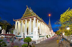
Nonthaburi is located in central Thailand, bordering Bangkok to the south and east, Pathum Thani and Phra Nakhon Si Ayutthaya to the north, and Nakhon Pathom to the west.
"ประกาศกระทรวงมหาดไทย เรื่อง จัดตั้งองค์การบริหารส่วนตำบลบางคูรัด อำเภอบางบัวทอง จังหวัดนนทบุรี เป็นเทศบาลเมืองบางคูรัด" [Notification of the Ministry of Interior Re: Establishment of Bang Khu Rat Subdistrict Administrative Organization, Bang Bua Thong district, Nonthaburi province Is Bang Khu Rat town municipality.] (PDF). Royal Thai Government Gazette. 136 (Special 33 Ngor): 15. 6 February 2019. Archived from the original (PDF) on September 23, 2019. Retrieved 30 October 2019.
"ข้อมูลสถิติดัชนีความก้าวหน้าของคน ปี 2565 (PDF)" [Human Achievement Index Databook year 2022 (PDF)]. Office of the National Economic and Social Development Council (NESDC) (in Thai). Archived from the original on 15 July 2025. Retrieved 12 March 2024. , page 37
"list of temples (1)". Retrieved 10 March 2026. , Sect Maha Nikai, no.212010101-212061101
"พระราชกฤษฎีกาจัดตั้งเทศบาลเมืองบางบัวทอง จังหวัดนนทบุรี พ.ศ. ๒๔๘๐" [Royal Decree Establish of Bang Bua Thong town municipality, Nonthaburi province, B.E.2480 (1937)] (PDF). Royal Thai Government Gazette. 54: 1859–1862. 14 March 1937. Archived from the original (PDF) on October 11, 2011. Retrieved 10 December 2019.
"ประกาศกระทรวงมหาดไทย เรื่อง เปลี่ยนแปลงฐานะเทศบาลตำบลไทรม้า อำเภอเมืองนนทบุรี จังหวัดนนทบุรี เป็นเทศบาลเมืองไทรม้า" [Notification of the Ministry of Interior Re: Establishment of Sai Ma Subdistrict Municipality, Mueang Nonthaburi district, Nonthaburi province Is Sai Ma town municipality.] (PDF). Royal Thai Government Gazette. 137 (Special 172 Ngor): 9–10. 29 July 2020. Archived from the original (PDF) on September 16, 2020. Retrieved 5 September 2020.
"list of temples (2)". Retrieved 10 March 2026. , Sect Dhammayut, no.612010101-612060401
"พระราชกฤษฎีกาจัดตั้งเทศบาลนครนนทบุรี จังหวัดนนทบุรี พ.ศ. ๒๕๓๘" [Royal Decree Establish of Nonthaburi city municipality, Nonthaburi province, B.E.2538 (1995)] (PDF). Royal Thai Government Gazette. 112 (40 Kor): 29–32. 24 September 1995. Archived from the original (PDF) on September 17, 2011. Retrieved 10 December 2019.
"ประวัติควมเป็นมา" [historical background] (in Thai). Retrieved 12 May 2026.
"ประกาศกระทรวงมหาดไทย เรื่อง จัดตั้งองค์การบริหารส่วนตำบลบางกร่าง อำเภอเมืองนนทบุรี จังหวัดนนทบุรี เป็นเทศบาลเมืองบางกร่าง" [Notification of the Ministry of Interior Re: Establishment of Bang Krang Subdistrict Administrative Organization, Mueang Nonthaburi district, Nonthaburi province Is Bang Krang town municipality.] (PDF). Royal Thai Government Gazette. 137 (Special 132 Ngor): 6. 4 June 2020. Archived from the original (PDF) on June 4, 2020. Retrieved 5 September 2020.
"พระราชกฤษฎีกาจัดตั้งเทศบาลเมืองบางกรวย พ.ศ. ๒๕๔๕" [Royal Decree Bang Kruai town municipality B.E.2545] (PDF). Royal Thai Government Gazette. 119 (122 Kor): 5–8. 16 December 2002. Archived from the original (PDF) on October 11, 2011. Retrieved 30 October 2019.
The shooting occurred on August 7, 2026, in Nonthaburi, Thailand.
Mulgrave is located 21 kilometres south-east of Melbourne's central business district.
The violin octet consists of eight acoustically scaled bowed string instruments.