Geography
2 min
Mulgrave Suburb History and Geography
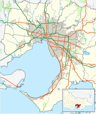
Mulgrave is located 21 kilometres south-east of Melbourne's central business district.
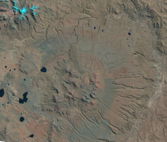
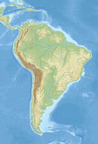
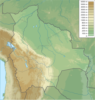
Cerro Panizos is a late Miocene-age shield-shaped volcano situated across the border of the Potosi Department in Bolivia and the Jujuy Province in Argentina. It is a significant component of the Altiplano–Puna volcanic complex (APVC), a region characterized by extensive calderas and associated ignimbrite deposits formed over the last ten million years. The volcano is also part of the Central Volcanic Zone (CVZ), a volcanic arc extending from Peru to Chile, primarily generated by the subduction of the Nazca Plate beneath the South American continent.
Volcanic activity in the APVC began approximately ten million years ago, leading to the development of major volcanic centers including Uturuncu and the calderas of Panizos, Vilama, and Cerro Guacha. The formation of these features is linked to a large magmatic body within the crust of the Central Andes.
Cerro Panizos is defined by its ignimbrite shield, which measures roughly 40 kilometers in width. It features two identified calderas, with a smaller collapse caldera nested within a larger one. The central area of the complex is marked by a semicircle of lava domes. Notable eruptions include the Cienago Ignimbrite, which released over 350 cubic kilometers of material approximately 7.9 million years ago, and the subsequent Panizos Ignimbrite, which erupted over 650 cubic kilometers about 6.7 million years ago. The rocks of the Panizos Ignimbrite are notable for containing orbs, which are structures formed by concentric layers of minerals.
The volcano is situated within the Cordillera de Lípez mountain range. Due to the arid climate of the high plateau, the region experiences minimal erosion, preserving the volcanic landforms. The landscape is characterized by conical and table-like shapes, with cliffs and rows of pinnacles formed by the erosion of the ignimbrite. The shield's surface has been compared to volcanic landforms on Mars, known as paterae.
The region is a cold, dry desert with high day-night temperature fluctuations. Vegetation is sparse, consisting primarily of cushion plants, grasses, and shrubs. The local fauna includes species such as guanacos, llamas, vicuñas, and various carnivores, including the Andean mountain cat and the cougar.
The area is remote and historically significant. Archaeological sites have been identified on the volcano, and evidence suggests that a branch of the Inca road system once traversed the site. While the central domes were first climbed in 1939, the volcanic nature of the complex was not formally identified until 1977, following analysis of satellite imagery.
Cerro Panizos is located in the Cordillera de Lípez range, spanning the Potosi Department in Bolivia and the Jujuy Province in Argentina.
Coira & Kay 1993, p. 308.
Ort 1993, p. 224; Infoleg 2024, Map.
Crucesnioc is also known as Crucesnioj or El Volcán, and Cerro La Ramada as Cerro Ramada.
González & Bergesio 2020, p. 155; Deroin et al. 2012, p. S41; Ort et al. 1989, p. 292.
Above sea level; they rise from a high terrain and thus the actual mountains are only about 1,600–1,700 metres (5,200–5,600 ft) high
Ort 1993, p. 224; Infoleg 2024, Map; Echevarría 1963, p. 441.
Guzmán et al. 2020, p. 1.
Ort 1993, p. 224; Coira et al. 2004, p. 110; Echevarría 1963, p. 442.
Ort, Coira & Mazzoni 1996, p. 310.
Coira et al. 2004, p. 55.
Mulgrave is located 21 kilometres south-east of Melbourne's central business district.
The violin octet consists of eight acoustically scaled bowed string instruments.
Goran Obradović was born on January 29, 1971.