United Kingdom Hydrographic Office
Supplying defence and the commercial shipping industry, they help ensure Safety of Life at Sea (SOLAS), protect the marine environment and support the efficiency of global trade.The Admiralty's first Hydrographer was Alexander Dalrymple,[2] appointed in 1795 on the order of King George III and the existing charts were brought together and catalogued.[citation needed] Dalrymple was succeeded on his death in 1808 by Captain Thomas Hurd, under whose stewardship the department was given permission to sell charts to the public in 1821.[4] In 1819, Captain Hurd entered into a bi-lateral agreement with Denmark to exchange charts and publications covering areas of mutual interest.In 1828 Captain Parry and the Royal Society organised a scientific voyage to the South Atlantic, in collaboration with the Hydrographers of France and Spain, using HMS Chanticleer.During his time as Hydrographer, he developed the eponymous Scale, saw the introduction of official tide tables in 1833 and instigated various surveys and expeditions.[10] In the 1870s, the Royal Naval Surveying Service supported the Challenger expedition, a scientific exercise that made many discoveries, laying the foundation of oceanography.In the Second World War, while led by Vice-Admiral Sir John A. Edgell, chart printing moved to Creechbarrow House in Taunton in June 1941.[16] In addition to traditional paper nautical charts and publications, the range has expanded to include a number of digital products and services.The UKHO is committed to the Information Fair Traders Scheme[22] and makes available for reuse those data that are collected as part of its Public Task,[23] which do not include third party Intellectual Property Rights.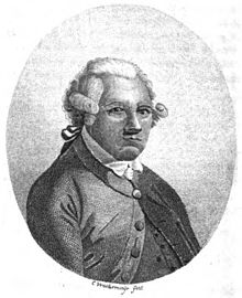


TauntonVernon CoakerMinister of State for DefenceMinistry of Defencehydrographicgeospatial dataSomersetSafety of Life at Sea (SOLAS)Admiralty chartsAlexander DalrympleConrad WestermayrAdmiraltyHydrographerGeorge IIIQuiberon BayBrittanySailing DirectionsNotices to Mariners (NMs)Thomas HurdDenmarkSir W. Edward ParryNorthwest PassageHMS ChallengerWilliam Frederick MitchellSouth AtlanticHMS ChanticleerSir Francis Beauforttide tablesHMS BeagleTierra del FuegoPatagoniaCaptain FitzRoyCharles DarwinSouth AmericaFalmouth, CornwallNew ZealandAustraliaRoyal NavyChallenger expeditionoceanographyHMS ChallengerInternational Meridian Conferenceprime meridianHydrographers to the Admiralty BoardJohn WashingtonGeorge Henry RichardsSir Frederick J. O. EvansSir William J. L. WhartonA. Mostyn Field'sNimrod ExpeditionErnest ShackletonRMS TitanicSafety of Life at Sea (SOLAS) conventionWorld War IInternational Hydrographic OrganizationSecond World WarSir Edmund G. IrvingGeorge Stephen RitchieSir David W. Haslamsurvey vesselHMS Vidalecho soundermultibeam surveyHMS Bulldogside-scan sonarBulldog-class survey vesselsNigel R. EssenhighElectronic Chart Display and Information SystemElectronic Navigational Charts (ENCs)HM Nautical Almanac OfficeThe Nautical AlmanacThe Astronomical AlmanacLaw of the Seamaritime limits and boundariesSmall Island Developing States (SIDS)trading fundPublic Data CorporationHydrographer of the NavyAdmiralty chartAustralian PilotGeospatial CommissionHydrographic officeNational Maritime MuseumDepartment of AdmiraltyOffice of First Lord of the Admiralty and President of the Board of AdmiraltyLord High Admirals CouncilAdmiralty buildingsBoard of AdmiraltyNavy BoardNavy OfficeNavy Pay OfficeOffice of the Naval SecretaryOffice of the First Naval LordOffice of the First Sea LordOffice of the Senior Naval LordOffice of the Parliamentary and Financial Secretary to the AdmiraltyOffice of the Permanent Secretary to the AdmiraltyOffice of the Private Secretary to the First Lord of the AdmiraltyOffice of the Naval Assistant to the First Sea LordOffice of the Additional Naval Assistant to the First Sea LordOffice of the Hydrographer of the NavyOffices of the Sea LordsAdmiralty Navy War CouncilAdmiralty War StaffAdmiralty Naval StaffAdministrative Planning DepartmentAdministrative Planning DivisionAir DivisionAnti-Submarine DivisionAnti-Submarine and Warfare DivisionAnti-U-boat DivisionAir Warfare DivisionAir Warfare and Fly Training DivisionAir Warfare and Training DivisionCommunications DivisionConvoy SectionEconomic Warfare DivisionGunnery and Anti-Aircraft Warfare DivisionGunnery DivisionGunnery and Torpedo DivisionHistorical SectionLocal Defence Division DivisionMercantile Movements DivisionNaval Air DivisionNaval Air Organisation and Training DivisionNaval Artillery and Torpedoes Division