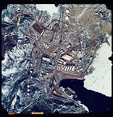
South Pole Traverse
Most crevasses occur in the short steep shear zone between them, where the road climbs along Leverett Glacier from near the southernmost point of the Ross Ice Shelf to the Antarctic Plateau more than 2,000 metres (6,600 ft) above sea level.[11] The National Science Foundation (NSF) funded a new "Traverse Program" in an effort to lower cost and potentially develop a more reliable method of supplying the South Pole Station.The road to McMurdo might provide a regularly maintained alternate route for such a link; however, opinions vary as to the shear zone section's suitability for a long-term cable.[13] A 7 February 2006 NSF press release stated that 110 tons (100 tonnes) of cargo had been delivered overland to the South Pole Station in a "proof of concept" of the highway.[16] In May 2013, a large land train of tracked vehicles got bogged down in a massive snow storm en route to the south pole, and it took several days to dig out.


Amundsen–Scott South Pole StationMcMurdo StationTransport in AntarcticaAntarcticaNational Science FoundationUnited StatescrevassesRoss Ice ShelfLeverett Glacierpolar plateauSouth PoleLC-130ground-penetrating radarCaterpillarCase CorporationMcMurdo Ice ShelfAntarctic Plateauoptical fiberConcordia StationDome Cgeosynchronous satellitespolar orbitsMaria LeijerstamrecumbentfatbikeColin O'BradyBorge OuslandEast AntarcticaWest AntarcticaIce roadsSouth Pole–Queen Maud Land TraverseThe Antarctic SunUnited States Army Corps of EngineersITworldThe IndependentThe GuardianWashington PostOutside Online