Sawiri, Lebanon
It is located in the West Bekaa District near the Syrian border, in the governorate of Beqaa in the foothills of the eastern mountains.Al-Masna (المصنع) is the main check point between the Lebanese & Syrian Borders and it is located in the territory of Sawiri.[2] Sawirah's population is over 20,000 people with many of its inhabitants having immigrated to the United States, Brazil, Argentina, Venezuela, Canada and France in the 1900s.At that time, the Sawiris used to continue their high school education in the neighbour towns of their village and then their university studies in Beirut.It is opposite the Tell Ain el Meten, a Heavy Neolithic archaeological site that was once used by the Qaraoun culture during the deforestation of Lebanon in prehistory.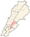
GovernorateBeqaa GovernorateDistrictWestern BeqaaTime zoneLebanonSyrianEli SmithSunni MuslimWest BeqaaBeqaa ValleyAlmondSterculia quadrifidaTell Ain el MetenHeavy NeolithicQaraoun cultureprehistoryMiddle PaleolithicEarly Bronze AgeMiddle Bronze AgeRobinson, E.Smith, E.Crocker & BrewsterAnjar, LebanonBaalbekWestern Beqaa DistrictJoub JannineAammiqAin ZebdehAitaniteBaaloulBab MareaaBaidar ech ChamoutDakoueGhazzehHaouch El HarimehKamid al lawzKefrayaKhiaraLibbayaMachgharaManaraMeidounQaraounSaghbineSohmorSultan YacoubTell ZenoubYohmorZilayaAmlaq QatihBustan Birke