Rashaf
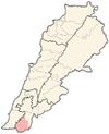
Rashaf or Rshaf (Arabic: رشاف) is a municipality in the Bint Jbeil District of the Nabatieh Governorate of Southern Lebanon, 16 kilometres from the Israel-Lebanon border.The following villages border Rashaf : Srobbine - Debel - Al Tiri - Haddatha - Beit Leif.It can be reached by several routes, such as the following : Sour - Aain Baal - Qana - Siddiqine - Kafra - Hariss - Haddatha - Rashaf In 1596, it was named as a village, ar-Rasaf, in the Ottoman nahiya (subdistrict) of Tibnin under the liwa' (district) of Safad, with a population of 51 households, all Muslim.The villagers paid a fixed tax rate of 25% on agricultural products, such as wheat, barley, fruit trees, goats and beehives, in addition to "occasional revenues"; a total of 2,720 akçe.[2][3] In 1881, the PEF's Survey of Western Palestine (SWP) described it: "A stone village, containing about 100 Metawileh, situated on a hill-top, with a few grapes, figs and olives, and arable cultivation; there is a spring near and cisterns in the village; also a birket for cattle.”[4] Following the 1982 invasion Rashaf became part of the Israeli ‘security zone’.
CountryLebanonGovernorateNabatieh GovernorateDistrictBint Jbeil DistrictTime zoneArabicSouthern LebanonIsraelPalmerAl TiriHaddathaHarissOttomannahiyaTibninbarleySurvey of Western Palestine (SWP)MetawilehHizbullahSouth Lebanon ArmyKatyushaMuslimsShiite MuslimsBeirutBint JbeilMiddle East InternationalLord MayhewDennis Walters MPYouTubeConder, C.R.Kitchener, H.H.Committee of the Palestine Exploration FundHütteroth, W.-D.Abdulfattah, K.Palmer, E.H.Rhode, H.Columbia UniversityAin EbelAitarounAynataAyta al-JabalAyta ash-ShaabBeit LifBeit YahounBaraashitBurj QalaouiyahDeir IntarAl-GhandouriyahAl-JumayjimahKfar DouninKherbet SelemKouninMaroun al-RasQalaouiyahAl-QaouzahRamiyahRmaishSafad al-BattikhShaqraSrobbinAs-SultaniyahAt-TiriYarounAard el BorjBelat templeChalaabounDouwaraKhallet el HamraWadi KouraWadi YarounWadi al-TaymWadi Saluki