Potosi, Texas
Potosi is located along FM 1750, approximately nine miles south of Abilene in east-central Taylor County.[4] According to the United States Census Bureau, the CDP has a total area of 18.5 sq mi (47.8 km2), all land.Potosi also borders the neighboring semiarid climate (Köppen BSh or BSk) of the west-central Texas region, which has characteristically long, hot summers and short, moderate winters.In 1893, R.A. Pollard applied for a post office and chose the name Potosi after the Mexican city of San Luis Potosí.Significant growth in the area, aided by its proximity to Abilene, began to occur in the late 1980s, and by 1992, 1,441 people were living in Potosi.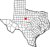
Census-designated placeCountryCountyTaylorTime zoneCentral (CST)ZIP codeArea codeFIPS codeTaylor County2010 censusAbilene, Texasmetropolitan statistical areaFM 1750United States Census BureauKöppen climate classificationhumid subtropical climatesemiarid climateMexicanSan Luis PotosíWylie Independent School DistrictBlack or African AmericanNative AmericanAlaska NativePacific IslanderMixed/Multi-RacialHispanic or Latino2020 United States censuscensuspopulation densityracial makeupper capita incomepoverty lineList of census-designated places in TexasThe Handbook of TexasBibcodeU.S. Census BureauTaylor County, TexasCounty seatAbileneCitiesTuscolaBradshawBuffalo GapImpactMerkel