Port St. Johns
This town is thought to have been named after a Portuguese ship (the São João),[2] which was actually wrecked at Port Edward.[2] In the mid-1800s the local Mpondo Chief, Ndamase, allowed a few white traders to settle at the mouth of the Umzimvubu River.On 17 July 1878, Chief Ndamase's oldest son Nqwiliso, reacted by ceding the western bank of the Umzimvubu River to the Cape Colony in return for being recognised as an independent ruler and he and his people were promised protection.Port St. Johns is situated on the Wild Coast on a coastline of about 270 km long.From Mthatha in the West and Flagstaff in the North the R61 road connects to Port St. Johns.
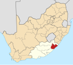
Port St. JohnCountrySouth AfricaProvinceEastern CapeDistrictO.R. TamboMunicipalityPort St JohnsBlack AfricanColouredIndianFirst languagesEnglishTime zonePostal codeWild CoastUmzimvubu RiverEast LondonMthathaPortuguesePort EdwardLusikisikiCape ColonysiltationTranskeiMzimvubu RiverIndian OceansandstonePort St. Johns Local MunicipalityO.R. Tambo District MunicipalityPondoland2011 censusTravertinehumid subtropicalKöppenprecipitationrelative humidityDeutscher WetterdienstFlagstaffR61 roadsardine runList of shark attacks in South African territorial watersBen DekkerOR Tambo District MunicipalityIngquza HillNyandeniBuntingvilleCanzibeLibodeNgqeleniNomcambaMhlontloKing Sabata DalindyeboCoffee BayMqanduli