Kotputli-Behror district
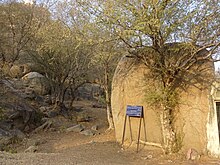
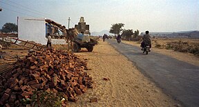
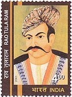
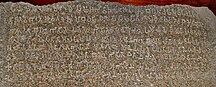
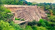
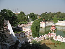
Located on the northernmost fringe of the Aravalli range this district is primarily composed of fertile plains and is traversed by the Sahibi River throughout its length.In the northwest, the Thar desert lies, also divided by chains of Aravalli Hills, which prevent its encroachment on the fertile plains.[11] There are no major surface water bodies like lakes except Buchara dam on Sota river and Babariya bund.The district is rich in Quarts and Granite minerals, though they are mostly found in ecologically sensitive Aravalli ranges.This river is also mentioned in ancient Indian texts of Manusmriti and Rigveda as southern boundary of the Brahmvrata, though there is difference in interpretations among experts.Viratnagar tehsil of the district finds mention in ancient Indian texts as the capital of Matsya Kingdom, the town is siad to have been founded by King Kirata where Pandavas spent their 12 years of exile in disguise.The town then located near the limestone hills was established faraway again and now is the headquarters of the eponymous Narayanpur Tehsil of the district.[15] Chieftainships In the subsequent tumultuous years Madan Singh, commonly known as Rao Made Chauhan, founded the village of Madanpur which is now known as Mundawar.After Sujaji's death in Samvat 1594 (AD 1537), his sons Rao Lunkaranji, Gopalji,Raisalji, Chandaji and Bheruji extended their authority to Khetri, Sikar, Khandela and Shahpura.But his son Jawahar Singh was defeated by the Jaipur ruler in the battle of Monda-Mandoli and lost the territory gained by his father.Bansur's landlords (Biswedars) revolted against the increase in tax by the Alwar king, which was brutally crushed, it is known as the Neemuchana massacre.On the morning of May 14, the army closed all the roads and started firing indiscriminately with machine guns on the village without any warning.According to the official government records, 156 died, while the non-official figures have claimed a horrific death toll of 1500 innocent people.This led to a strong reaction across the country at that time.According to Census of India 2011, three most important commodities manufactured in towns and cities were reported to be as following - Cement Production, Granite Tiles, Sunmica in Behror ; Cotton Yarn, Electric Wire in Neemrana ; Wooden Furniture, Textiles, Mustard Oil in Shahjahanpur ; Vanaspati Ghee, Mustard Oil, Grain Products in Kotputli ; Leather Shoes (mojadis) in Viratnagar respectively, though these have changed rapidly in recnet years.Located on Bijak Ki Pahari these buddhist complexes are the testimony to regions cukturally rich past.The famous Neemrana fort was built in the 16th century and was occupied by Chouhans claiming to be descendants of Prithviraj of Ajmer till 1947.[25] Taseeng Fort located in Aravali hills 5 km away from Behror headquarters is another place of attraction but now in poor condition due to neglect.These are minor rock edicts found near Bhabru hills, now located in Museum of Asiatic Society Kolkata.[29][30]It is an ancient devi temple located on the banks of Sota River atop a hillock, in Saroond Village on Kotputli NeemkaThana Highway.[32] RTDC Midway Behror is an important public hotel and landmark situated midway between Delhi and Jaipur on NH-8 Where leaders of different states and of different countries, former Prime Minister Atal Bihari Vajpayee, administrative officers and judicial officers, besides foreign ambassadors have tasted Rajasthani flavors.[1] This fort was built under reign of Mughal Emperor Akbar to rein in the frequent attacks on Commercial convoys towards alwar by Bandits.Rundhs were the reserve forests under the Alwar Princely state used for Hunting by royals andas large grazing lands.Rajasthan's first Integrated public health lab was established in PBDM hospital Kotputli with support of CDC On 22 June 2023.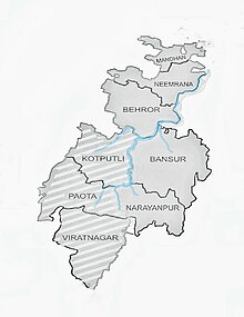


BehrorKotputliDistrictRajasthanBairat TempleNeemranaJaipurTehsilsBansurViratnagarTime zoneVehicle registrationMajor highwaysJaipur districtAlwar districtMundawarKotpultiSahibiAravaliShahpuralimestonesandstoneSariska Tiger ReserveThar desertephemeralHaryanaYamunaAditya Birla GroupUltraTech CementAshokaMinor Rock Edictsarchitecture of IndiaRajasthaniAhirwatiDainik NavjyotiDainik Bhaskar