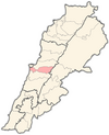
Kfar Silwan
Kfar Silwan has an average elevation of 1,380 metres (4,530 ft) above sea level and a total land area of 1,471 hectares.[2] Kfar Silwan was the ancestral village of the Abu'l-Lama muqaddams (local chiefs), a Druze family affiliated with Fakhr al-Din II (fl.From Kafr Silwan, the Banu Hatum led a peasants' revolt in the early 1790s against the taxation attempts of Bashir Shihab II, the paramount tax farmer of Mount Lebanon and its environs, forcing his troops to withdraw from the Matn area.[5] In 1794 the revolt was suppressed by the forces of the Ottoman governor Jazzar Pasha, the village was destroyed and part of its inhabitants, including the Banu Hatum, migrated to the Hauran.[6] In 1838, Eli Smith noted Kefr Selwan as a village located in Aklim el-Metn; East of Beirut.
SilwanLebanonGovernorateMount LebanonDistrictBaabdaArabicBaabda DistrictMount Lebanon GovernorateBeiruthectaresMaronitesmuqaddamsFakhr al-Din IISalimaMaronite ChristianityBashir Shihab IIOttomanJazzar PashaHauranEli SmithDruze in LebanonMaronite Church in LebanonAbu-Husayn, Abdul-RahimRobinson, E.Smith, E.Crocker & BrewsterAbadiyehAin El RemmanehBourj el-BarajnehBtekhnayBzebdineChbaniyehChiyahFalougha-KhalouatGhobeiryHadathHammanaHaret HreikHazmiyehJouar el-HaouzKfarshimaQarnayelRas el-Matn