Jumla District
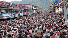
This district has Jumla as its headquarters, an area of 2,531 square kilometres (977 sq mi); it had populations of 89,427 and 108,921, respectively, in the national censuses of 2001 and 2011.[8] In the late 18th century the Jumla kingdom successfully defended itself against the first attack by King Prithivi Narayan Shah, and legend even has it that he got injured in the battle.[10] The Jumla kings belonged to the Kalyal dynasty, linked to the Mewar clan of Rajasthan, India.[13] Ethnicity/caste: 60.4% were Chhetri, 10.9% Hill Brahmin, 7.4% Kami, 7.4% Thakuri, 7.1% Sarki, 2.5% Damai/Dholi, 1.1% Sanyasi/Dasnami, 1.1% Tamang, 0.9% Lohar, 0.2% Gharti/Bhujel, 0.2% Newar, 0.1% Bhote, 0.1% Gurung, 0.1% Magar, 0.1% Musalman, 0.1% Thakali and 0.2% others.[27] An "inter-caste economic dependency in a long-term hereditary contractual labor relations" is called Lagi-Lagitya.[29] The Himalayan Black Bear damages crops and attacks livestocks but locals support the animal's conservation.[31] Jumli Marshi is a high altitude rice variety that is thought to have been cultivated in Jumla since 1300 years ago.
DistrictSinja ValleyCountryProvinceKarnali ProvinceMunicipalityChandannathKankasundariGuthichaurTatopaniPatarasiCoordination committeeParliamentary constituenciesJumla 1Provincial constituenciesDemographicsChetriThakuriHuman Development IndexTime zoneOfficial languageJumli KhasNepaliMajor highwaysKarnalidistrictsNepali languageKhas languageKhas KingdomKhasa kingdomBaise RajyaPrithvi Narayan ShahGorkhaBahadur ShahYatse (Malla)MustangUttarakhandEast India CompanyNir ShahTemperate2011 Nepal censusTamangSherpaChhetriHill BrahminBhujelGurungMusalmanThakaliBuddhistChristianMuslimFormer administrative units of NepalGovernment of Nepalconstitution of Nepal 2015The Himalayan TimesJournal of Nepal Health Research CouncilMunicipalities: 1Rural municipalities: 7municipalitiesrural municipalitiesProvincesBhojpurDhankutaKhotangMorangOkhaldhungaPanchtharSankhuwasabhaSolukhumbuSunsariTaplejungTehrathum UdayapurMadheshDhanushaMahottariRautahatSaptariSarlahiSirahaBagmatiBhaktapurChitwanDhadingDolakhaKathmanduKavrepalanchokLalitpurMakwanpurNuwakotRamechhapRasuwaSindhuliSindhupalchokGandakiBaglungLamjungManangMyagdiNawalpurParbatSyangjaTanahunLumbiniArghakhanchiBardiyaEastern RukumKapilavastuParasiPyuthanRupandehiDailekhJajarkotKalikotSalyanSurkhetWestern RukumSudurpashchimAchhamBaitadiBajhangBajuraDadeldhuraDarchulaKailali