Erie County, Pennsylvania
Prior to 1792, the region was claimed by both New York and Pennsylvania and so no county demarcations were made until the federal government intervened.Erie County resembled Upstate New York more than it did Pennsylvania with its population primarily consisting of settlers from Connecticut, Rhode Island and Maine.[7] Roads were laid out, post routes established, public buildings erected and people were invited to move there.With the exception of a high ridge several miles from the lake, running nearly parallel with its shore, the terrain is generally rolling and well watered.Other notable population centers include Millcreek, Harborcreek, Summit and Fairview townships, and the boroughs of Edinboro, North East, Girard, Waterford and Union City.[20] Chart of Voter Registration Unlike most of northwestern Pennsylvania, Erie County tends to lean Democratic in statewide and national elections.The County Executive's administration took the lead in presenting the proposal to the Pennsylvania State Board of Education for approval, supported by a cross-section of business, civic, labor, and community leaders.The Main Library is praised for its waterfront views of the Presque Isle Bay, where the historic U.S. Brig Niagara is often located.The library was moved to this location approximately 25 years ago, from its previous home in the center of downtown Erie.[28] The second floor of the Main Library is home to an art collection, containing historic pieces like Summer Afternoon, Isle of Shoals by Frederick Childe Hassam.[28] The library also provides a heritage room where one can conduct genealogy research concerning their ancestors who resided in Erie County or Northwest Pennsylvania.[30] Under Pennsylvania law, there are four types of incorporated municipalities: cities, boroughs, townships, and, in at most two cases, towns.The following cities, boroughs and townships are located in Erie County: Census-designated places are geographical areas designated by the U.S. Census Bureau for the purposes of compiling demographic data.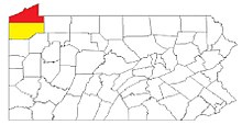
Meadville, PA
Micropolitan Statistical Area


Erie CountyErie County, New YorkErie County, OhioCountyErie Federal CourthouseErie, PennsylvaniaPennsylvaniaNamed forErie peopleTime zoneUTC−5EasternUTC−4Commonwealthcounty seatAllegheny CountyErie TriangleMercerVenangoMeadvilleYankeeUpstate New YorkConnecticutRhode IslandNew EnglandYankeesUnderground RailroadU.S. Census Bureau42nd parallelChautauqua County, New YorkWarren CountyCrawford CountyAshtabula County, OhioLake ErieCanadahumid continental climatehardiness zoneNew YorkCanadian borderHaldimand County, OntarioNorfolk County, OntarioUS 6NUS 19US 20PA 5 Alt.PA 18PA 77PA 89PA 97PA 98PA 99PA 215PA 226PA 290PA 426PA 430PA 474PA 505PA 531PA 8322010 censuspopulation densityBlack or African AmericanNative AmericanPacific Islanderother racesHispanic or LatinoGermanPolishItalianEnglishAmericanmarried couplesOther/MixedHispanicLatinoList of Metropolitan Statistical AreasList of Combined Statistical AreasErie, PA Metropolitan Statistical AreaMicropolitan Statistical AreaUnited States Office of Management and BudgetMetropolitan Statistical Area2010 U.S. Census164th-most populousErie-Meadville, PA Combined Statistical AreaCombined Statistical Area102nd-most populousMillcreekHarborcreekFairviewSummitNorth EastEdinboro2016 presidential electionDonald TrumpJoe BidenRepublicanDemocraticThird party(ies)county executiveKathleen DahlkemperPerry SquareIndependentThird PartybellwetherDan LaughlinPennsylvania's 49th Senatorial DistrictScott HutchinsonPennsylvania's 21st Senatorial DistrictPatrick J. HarkinsPennsylvania's 1st Representative DistrictRobert MerskiPennsylvania's 2nd Representative DistrictRyan A. BizzarroPennsylvania's 3rd Representative DistrictJake BantaPennsylvania's 4th Representative DistrictBrad RoaePennsylvania's 6th Representative DistrictJohn FettermanDave McCormickMike KellyPennsylvania's 16th congressional districtCorry Area School DistrictErie City School DistrictFairview School District