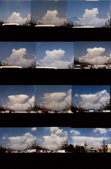
Cumulonimbus cloud
Cumulonimbus (from Latin cumulus 'swell' and nimbus 'cloud') is a dense, towering, vertical cloud,[1] typically forming from water vapor condensing in the lower troposphere that builds upward carried by powerful buoyant air currents.Above the lower portions of the cumulonimbus the water vapor becomes ice crystals, such as snow and graupel, the interaction of which can lead to hail and to lightning formation, respectively.Cumulonimbus clouds can also occur as dangerous winter storms called "thundersnow" which are associated with particularly intense snowfall rates and with blizzard conditions when accompanied by strong winds that further reduce visibility.Cumulonimbus are a notable hazard to aviation due most importantly to potent wind currents but also reduced visibility and lightning, as well as icing and hail if flying inside the cloud.Wind shear within and under a cumulonimbus is often intense with downbursts being responsible for many accidents in earlier decades before training and technological detection and nowcasting measures were implemented.


Thunderclouds (song)CalvusCapillatusPrecipitationsnow pelletsWeatherTemperate and polar seasonsWinterSpringSummerAutumnTropical seasonsDry seasonHarmattanWet seasonStormsArcus cloudDownburstMicroburstHeat burstDerechoLightningVolcanic lightningThunderstormAir-mass thunderstormThundersnowDry thunderstormMesocycloneSupercellTornadoAnticyclonic tornadoLandspoutWaterspoutDust devilFire whirlAnticycloneCyclonePolar lowExtratropical cycloneEuropean windstormNor'easterSubtropical cycloneTropical cycloneAtlantic hurricaneTyphoonStorm surgeDust stormSimoomHaboobMonsoonAmihanSiroccoFirestormWinter stormIce stormBlizzardGround blizzardSnow squallDrizzleFreezingGraupelMegacryometeorIce pelletsDiamond dustCloudburstRain and snow mixedSnow grainsSnow rollerTopicsAir pollutionAtmosphereChemistryConvectionPhysicsClimateSeasonCold waveHeat waveJet streamMeteorologySevere weatherExtremeCanadaUnited StatesWeather forecastingWeather modificationClimate changeTornado termsTropical cyclone termswater vaportropospherebuoyantice crystalsthunderstormssquall linestornadoescumulus congestus cloudsafterglowozone layerstratospherecumuluswind shearinversionequilibrium leveltropopauseovershooting topmaximum parcel levelCumulonimbus calvusCumulonimbus capillatusCumulonimbus flammagenituswildfiresvolcanic eruptionsoutflowPannusPileusmammatusfunnel cloudFlanking lineprecipitation shaftrain shaftCrown flashconvectiveflash floodingstraight-line windsdowndraftupdraft