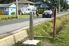
Boundary marker
[1] According to Josiah Ober, boundary markers are "a way of imposing human, cultural, social meanings upon a once-undifferentiated natural environment."[12] In ancient Thailand, sacred boundary stones called Sema Hin delimited Buddhist temple precincts.In some cases they feature inscriptions recounting the history of the temple;[citation needed] others were carved with wheels of the law,[13] while some specimens consist of unfinished stone.They defined the limits of the sacred city of Akhet-Aten, built by Akhenaten as the center of the Aten religious cult which he founded.The Sweden-Finland border on Märket is marked with holes drilled to the rock, because seasonal pack ice can shear off any protruding markers.In folklore, a type of haltija, rajahaltija, a kind of a local spirit, was believed to haunt borders that had been unjustly moved.These altars served not only as boundary markers but also as sites for the performance of religious rituals related to land taxation.[24] C. J. Lyons, an early surveyor of Hawaii,[25] recorded that "[u]pon this altar at the annual progress of the akua makahiki (year god) was deposited the tax paid by the land whose boundary it marked, and also an image of a hog, puaa, carved out of kukui wood and stained with red ochre.Although the original surveyors intended each side to be ten miles (16 kilometers) long, their measurements were often inaccurate, resulting in the sometimes significant misplacement of stones and the overall skewing of the District boundaries.In the twentieth century, the Daughters of the American Revolution voluntarily took responsibility for preserving the stones, which had fallen victim to vandalization and urban development.Commissioned by the Spanish Crown, it consisted of a cross made from alder wood and placed standing upright on a rock.[32] A block cut from sandstone was placed at the intersection of Wyoming, Colorado and Utah in 1879,[33] and stone posts were used along the western border of South Dakota.


Boundary Stones (Ukraine)0 AvenueMaesglasePrincipality of LippeKingdom of PrussiaboundarylatitudelongitudestatesOperation BarbarossaGlacial erraticsmunicipalitiesKurjenrahka National ParkFinnish-Russian borderTreriksrøysaThree-Country CairnMärketpack icehaltijaBarsinghausenDeisterLower SaxonyDreieckiger PfahlKingdom of HanoverDuchy of BrunswickWolfsangelDuchy of Brunswick-LüneburgLimes border wallRoman EmpireTerminusPrincipality of MonacoKingdom of Piedmont-SardiniaFontvieilleMenton-GaravanRoquebrune-Cap-MartinMentonMonacoRoquebruneHouse of SavoyGreenwich129th meridian eastWestern Australian borderObeliskCameron CornerHaddon CornerPoeppel CornerSurveyor Generals CornerBoundary markers of the original District of Columbiafirst boundary markerBaja CaliforniaSpanish CrownMason–Dixon lineFeldkirch, AustriaMauren, LiechtensteinNorwaySwedenArcticPasso San GiacomoVal FormazzaVal BedrettoBoundary stone of the original District of ColumbiaWashington, D.C.MarylandUnited StatesMurat-sur-VèbreFraisse-sur-AgoutHanoveriancommonGeorge II of Great BritainElector of HanoverHensbroekSchardamcoat of arms of HoornMount NuangSelangorPahangMalaysia49th parallel northCanadaUkraineFinland–Russia borderCloptonLilford-cum-WigsthorpeBaarle-HertogBelgiumBaarle-NassauNetherlandsThe NetherlandsCadzand-BadMilestoneSumedang RegencyBandung RegencyIndonesiaBandung CityCimahi CitygovernmentcastersimmigrationHelsinki-Vantaa Airporttriangulation stationFangchuanChina–North Korea–Russia tripointHavantBai SemaBorder barrierButts and boundsDreiherrensteinKudurruLandmarkkilometreSurvey markerTripointBlomley, NicholasWayback MachinePerdue, Peter C.Woodward, Hiram W.Murnane, William J.California Historical Society Quarterly
